KEY CONCEPTS
Extreme rainfall patterns are changing due to climate change. Over the past 70 years, 79% (191) of the 242 stations analyzed recorded an increase in heavy rainfall.
A warmer climate supercharges the water cycle, by causing more water to evaporate and allowing the atmosphere to hold more water vapor.
Flood defense infrastructure can help to mitigate the risks of heavy rainfall, but reducing greenhouse gas emissions is the only way to stabilize both our climate and water cycle.
Back to Top
READY-TO-USE GRAPHICS
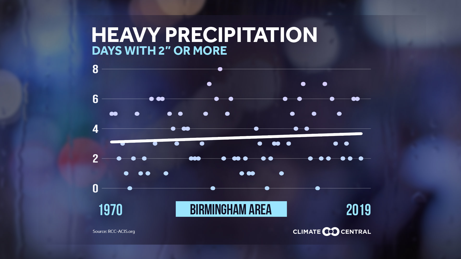
Local: Heavy Rain Trends
Find Images for All Available Cities Here (JPG & PNG)
National: 1 day rainfall totals compared to average
Find Images for All Available Scenarios Here (JPG & PNG)
If the old adage is anything to go by, May should bring plenty of flowers (to much of the country)! While seasonal weather patterns like April showers seem to endure, long-term averages show that climate change is fundamentally changing other aspects of precipitation—making heavy rainfall events more common and more intense. In recent years, an increasing percentage of precipitation has come from intense, single-day events.
Climate Central analyzed how heavy rain events are changing in U.S. cities since 1950. Since the amount of rain that falls in a heavy rain event varies dramatically from the Desert Southwest to the downpours of Florida, this analysis calculated trends in ½, 1, 2 or 3-inch events, as appropriate to the location (see Methodology for more details). Over the past 70 years, 79% (191) of the 242 stations analyzed recorded an increase in heavy rainfall.
In a warming climate, not only does more water evaporate into the atmosphere (roughly 70% of Earth is made of water), but the atmosphere is also capable of holding more water vapor—for every 1°F increase in temperature, the atmosphere can hold approximately 4% more water. This supercharging of the water cycle is making for an increase in rainfall events that are more likely to create disruptive and even dangerous conditions in our daily lives. While adaptation measures can be taken to mitigate the impacts of heavy rain, reducing greenhouse gas emissions is the only way to begin stabilizing our climate and water cycle.
For more on heavy rain and climate change, check out:
Our analyses of local trends in the wettest day of each year, increases in downpours by region, as well as 2019 year-end precipitation trends and rankings.
SciLine’s reporter fact sheet for helpful tips and resources.
Back to Top
POTENTIAL LOCAL STORY ANGLES
How much precipitation is happening near you?
You can find interactive state and county precipitation maps going back to 2001 at NOAA’s National Centers for Environmental Information, as well as a look at precipitation records, updated monthly. And NOAA’s State Climate Summaries provide science-based information on state climate characteristics, historical and future trends, downloadable data, and easy-to-digest fact sheets. If you want to learn about how climate change may be affecting precipitation in your area, you can find regional summaries in the National Climate Assessment.
Is flooding an issue in your state?
Heavy precipitation doesn’t always lead to flooding, but if you want information about local flooding issues, check out the Association of State Floodplain Managers (ASFPM), which has 37 state and regional chapters that promote education and policies to mitigate current and future losses from flooding. Also, FEMA collects information on flood insurance for each state and you can check out NOAA’s interactive billion-dollar weather and climate disasters website to find historic events near you. Pew Charitable Trusts has compiled research on local flood mitigation efforts around the country, and the National Conference of State Legislatures collects resources on state level actions on flood issues.
What does your local watershed have to do with precipitation?
Healthy watersheds with well-managed floodplains can help make local communities more resilient to extreme rainfall and flooding. They can also improve our water quality and store carbon. Find more information about the importance of watersheds from the U.S. Geological Survey, and find tools for exploring your local watershed on the EPA’s Healthy Watersheds Protection page.
Back to Top
EXPERTS TO INTERVIEW
Karin Gleason, Meteorologist - Monitoring Section, NOAA's National Centers for Environmental Information (NCEI), Center for Weather and Climate (CWC), Karin.L.Gleason@noaa.gov
Dr. Samantha Montano, Assistant Professor of Emergency Management, Massachusetts Maritime Academy, samanthaLmontano@gmail.com
The SciLine service,500 Women Scientists or the press offices of local universities may be able to connect you with local scientists who have expertise on changing climate patterns in your area. The American Association of State Climatologists is a professional scientific organization composed of all 50 state climatologists.
Back to Top
METHODOLOGY
Climate Central analyzed the annual number of calendar days with rainfall totals exceeding certain thresholds (inches). Specific thresholds were determined based on the largest daily threshold in inches that occurred at least two times a year on average. Rainfall amounts are from the Applied Climate Information System. Trends are based on a mathematical linear trend line, beginning in 1950 for consistency between stations. Only 242 of our 244 stations are included in summary statements due to large data gaps in St. Johnsbury, Vt. and Wheeling, W. Va.
Trends in one-, two-, and three-inch rainfall analyses are based on a methodology from Brian Brettschneider (Climate researcher at University of Alaska-Fairbanks) and represent a percentage of the long term average. For example, if a station averaged 20 days per year with at least 1" of precipitation, a year with 22 days would be recorded as 110% of the average. This averaging technique was performed for all stations, in all years, for each precipitation threshold.
Back to Top
